Monday, June 4, 2012

Island Peak - 123 Days to Departure - Mt.Ellinor

With so many choices here in Washington State, there are mountains we climb and take off the list once and for all, and then there are those which makes us return year after year.  For me, Mt. Ellinor is one of the latter kind.

Located on the Kitsup Peninsula about 15 miles past small town of Hoodsport, this mountain has a reputation of being a short but grueling climb making one’s knees squeak. That might be true in the summer, when a narrow trail zigzags up the steep slopes to the prime views of the Olympics; however for many climbers the spring – after avalanche danger subsides but there is still enough snow pack left for the chute route -  is the preferred time to go.


There are 3 possible starting points for this climb, some might not accessible earlier in the season. The longest one starts from the lower trailhead and gains 3400 ft in about 2.5 miles. On the contrary the shortest one, starting from the upper trailhead, will gain about 2400 feet in approximately mile and half. And then there is a nice scenic ridge run in between those two.

The day was supposed to be partly sunny but the closer we got to the mountain, the faster our hopes to see any sunshine faded. The area was engulfed in a thick layer of clouds with an occasional sucker patch letting our eyes feast on a view that vanished as quickly as it appeared. The breeze, touched by the sporadic remnants of the snow pack, carried the chilliness of the cloudy morning.


Usually, we start at the lower trailhead but this time we drove higher up, and parked together with 4 other vehicles at the intersection with Jefferson Pass, where in a shady corner a mile from the upper trailhead sizeable snow patch blocked the road.

The forest was peacefully quiet, for the first half mile we had it all to ourselves.  We made several brief stops here to admire the softness of the pine needles, baby bear grass getting ready to bloom, and the most interesting piece of bark peeling of a tree in layers.

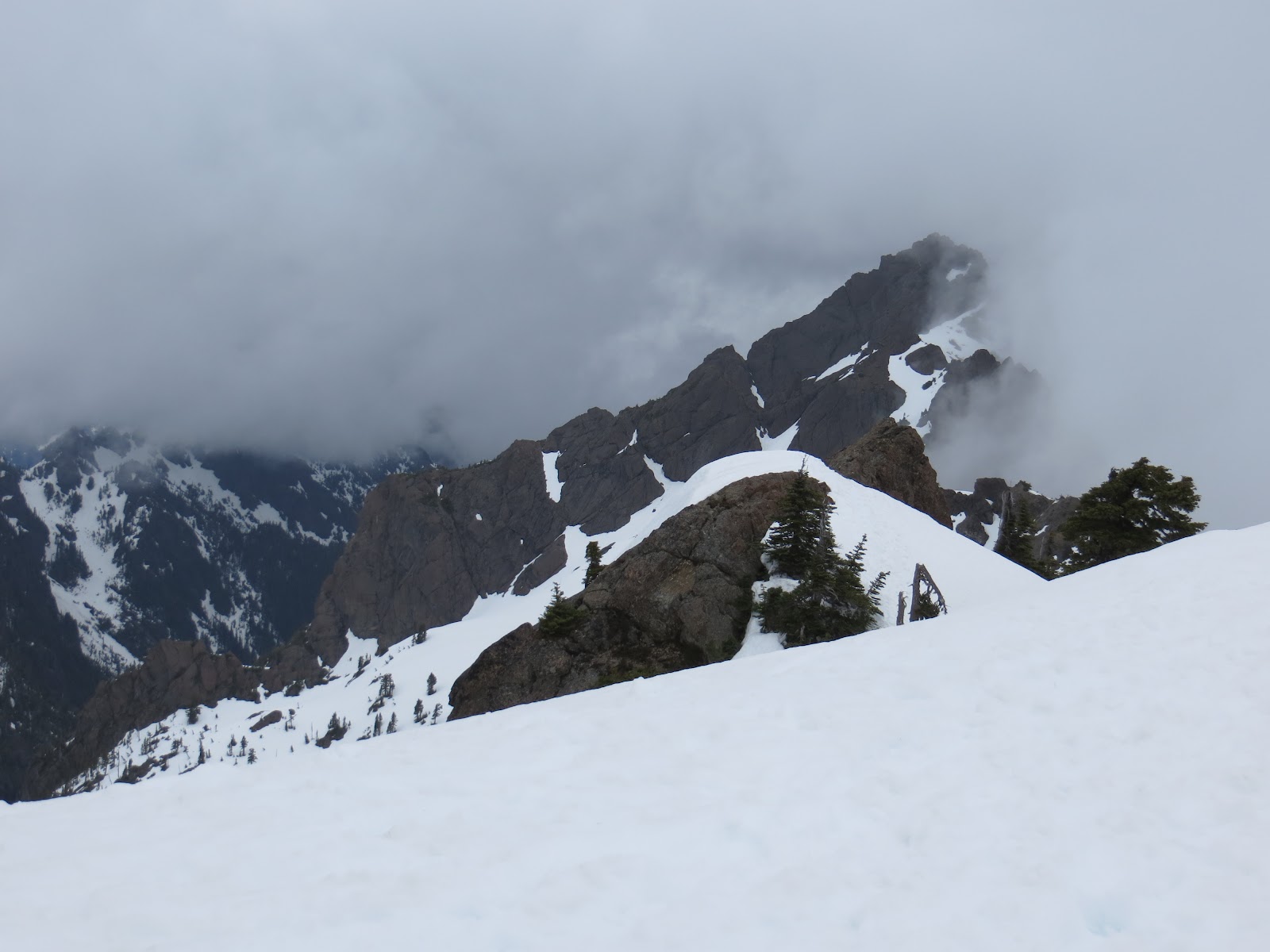
Most of the uphill was covered on dirt. The snow started just below the area where the trail flattens a little and starts heading for the chute where we arrived just at a time a patch of blue sky let us snap a quick picture, then the whole route once again hid in clouds.


There were others who likely just like us arrived hoping for a nice weather, and were now making their way up the chute, step by step slowly disappearing in the fog. We followed shortly after a quick gear up break. The staircase of frozen steps kicked by fellow climbers earlier was in a great shape. Crampons were not necessary; however I found them helpful, especially when a step off path was required, where the snow was solid and still rather slippery.

Passing several members of the group ahead of us, encountering one goat at the first false summit, and enjoying about 3 moments of sunshine, each lasting for no more that 10 seconds, we made a good time to the top. The view into the Olympics, even though roofed by dark cumulous clouds, was open, and a tiny sucker patch above the summit rocks allowed a peak into the Lake Cushman area. It was kind of like looking through a window, very cool experience actually.


The summit stay was windless and rather enjoyable. Looking towards the neighboring Mt. Washington, we discussed the possible traverse route with one of the locals who has done it several times, and just before our departure, a group of girls shared some of the wine they brought to the top with us.


And then…. of course there was the glissade. More solid at the top, not dangerously icy but hard enough to make bumps hurt, with some tricky spots trying to avoid a tree, dropping adventurers into a deep corridor, and spitting them at the flat area of the false summit. The bottom part was much smoother ride, long, curvy, most enjoyable with the snow softening with elevation lost, leaving us looking forward for next year!

Friday, June 1, 2012

Island Peak - 144 Days to Departure - Mt. Hood


The highest peak in Oregon, Mt. Hood was on our list for about a year. We missed the opportunity to climb it last season, and were keeping a close eye on how this year is unraveling, so when the reports suggested good climbing conditions and weather looked awesome for the whole weekend and beyond, it was a GO.


The long drive to Timberline Lodge was highlighted by a brief lunch stop in Portland during which we also visited the famous Powell’s bookstore, and strolled through a small food market in a hope to catch the Czech stand but they were not there.

The forecast did not lie; the sky was clear blue and temperature in high 70’s. With the Jeeps’ top off we cruised through small communities of Rhododendron and Government Camp, from where we turned to the winding road up to the trailhead.


After registering for the climb and a brief visit of the lodge, we still had time on our hands, so off we were back to Government Camp for an early dinner and several hours of rest at local Best Western.

 The stars were out and moon shined bright when we once again stood at the trailhead at a wee morning hour – just little bit past midnight. The first part of the route was a non technical slog taking us to the top of the ski lift. The terrain was uneven, crossed by multiple sets of frozen footsteps and CAT tracks here, making progress slower than anticipated.


From the top of the Palmer's lift, the route got steeper but still led on a non technical terrain. Here, little above 9000 feet, my body started reacting to the altitude. I felt sluggish, not short of breath, just little nauseated and not quite motivated to make another step.

The avalanche forecast was not good for today. We knew our chances of summiting more or less laid in Mother Nature's hands, and not feeling my best, I set a goal for myself to make it to the Hogsbacks, from avalanche perspective the safe part of the route, and I was quite happy to call it a day there. Yet then the sun started to rise... and we found ourselves surrounded by tall walls covered in white frosty coating reflecting the colors of the rising day, several camp sites tucked in the few wind sheltered areas along the route, and finally the famous Hogsback itself. The scenery was truly spectacular, feeding my eyes and mind with much needed fuel, and after a brief stop to snack and assess the conditions (the route turned out to be in a great shape), I found myself having plenty of energy to continue further so we geared up and off we were for the push to the summit via the Old Chute Route.


The sound of ice crystals constantly shifting down the slope accompanied our steps, at one point their flow was strong enough to cover the route, swallowing our feet in the appr. 5 inches of ice shatters. Then the last uphill came, luckily the group ahead of us kicked decent steps in the steep slope, and we took this staircase directly to the heavenly views of the summit ridge. From there it was just a matter of few minutes to cross to the very top of the mountain where, just as expected, gust slapped our faces, chasing us down after only few minutes and several quick photos.


Date: 5/13/2012
RT: 7 miles
El: Gain: 5200 ft