Showing posts with label spring. Show all posts

Wednesday, May 21, 2014

Havasu Falls, Arizona - 4/27/2014

Standing at the Hualapai Hilltop we are admiring the vast barren canyon as it opens in front of us. Prominent cliffs of Coconino Sandstone are met here with red tones of the slope forming Hermit Shale layer. A feast for the eye. 


 Quick sunscreen application and the adventure can start. Series of switchbacks drop us to the canyon floor. From there the trail takes a gentle, nearly flat grade. It’s a scenic walk during which we have the opportunity to admire from up close and personal the different layers of rock in which the hues of red become more and more prominent as we are getting lower.


About six miles down the trail Hualapai and Cataract Canyons intersect to form Havasu Canyon, home of the most idyllic waterfall settings I had ever seen. But before we even get a glimpse of the waterfalls, we have to pay visit to the tourism office in Supai Village where we settle our fees and receive a green wristband which lets us meander here freely for the next 2 days. There are about 43 households in Supai, which is also the capital of the Havasupai Indian reservation, a lodge, 2 stores and a cafe. They sell fry bread at the cafe which makes it a mandatory stop.


The last couple miles of day 1 are a stroll along a stream. Even though we thoroughly enjoyed the scenery of the upper canyon, the presence of the water is refreshing. It brings lush greens and colorful blooms.

Just a short walk from the village we come across the first waterfall. Navajo Falls came to being in 2008 when flood moved massive amount of rock and mud, carving a deep bed for the water to flow through. The creek erupts from vegetation in several different streams and falls into pools below. It is an amazing scene which makes us stop for nearly 30 minutes. The camera clicks frequently during this stp as we try to capture the beauty from any accessible angle.


Havasu Fall has completely different appearance. The vibrant blue water contrasts against the striking red rock of the canyon walls as the waterfall plunges nearly 100 feet into a wide pool. There are many people down by the pool , sunbathing or swimming. It is hot on the sun and a dip in the cool water sounds tempting.

To Havasu Falls we head after the camp is set. I like our camping spot on a soft sandy bank with a background music of nearby creek and frogs living in its shallow water. We even have a large picnic table, a luxury we seldom enjoy while backpacking.


The easily accessible plunge pool bellow Havasu Fall is a popular place. Many people are gathered here even now in late afternoon. The water is said to be around 70 degrees. It fels cool as I make my first step in but it does not take long for my body to adjust. Some people are swimming. With the sun setting behind the rock wall, I don't have a desire to jump to the pool head to toe, wading in the knee deep water further from the waterfall suits me fine. 

After dinner we head to Mooney Falls which is not far downstreat from our campsite. Havasu is said to be the main attraction of the valley but I find Mooney Falls jut as magnificent. Each drop falls with its own clarity, making a vast splash upon the level surface below. The sleek sapphire descent is simple staggering to observe. 


Tomorrow, if we dare to descent on a cliff aided by chains and ladders, we will follow the river flowdeeper into the canyon for more breathtaking scenery.


Monday, June 4, 2012

Island Peak - 123 Days to Departure - Mt.Ellinor

With so many choices here in Washington State, there are mountains we climb and take off the list once and for all, and then there are those which makes us return year after year.  For me, Mt. Ellinor is one of the latter kind.

Located on the Kitsup Peninsula about 15 miles past small town of Hoodsport, this mountain has a reputation of being a short but grueling climb making one’s knees squeak. That might be true in the summer, when a narrow trail zigzags up the steep slopes to the prime views of the Olympics; however for many climbers the spring – after avalanche danger subsides but there is still enough snow pack left for the chute route -  is the preferred time to go.


There are 3 possible starting points for this climb, some might not accessible earlier in the season. The longest one starts from the lower trailhead and gains 3400 ft in about 2.5 miles. On the contrary the shortest one, starting from the upper trailhead, will gain about 2400 feet in approximately mile and half. And then there is a nice scenic ridge run in between those two.

The day was supposed to be partly sunny but the closer we got to the mountain, the faster our hopes to see any sunshine faded. The area was engulfed in a thick layer of clouds with an occasional sucker patch letting our eyes feast on a view that vanished as quickly as it appeared. The breeze, touched by the sporadic remnants of the snow pack, carried the chilliness of the cloudy morning.


Usually, we start at the lower trailhead but this time we drove higher up, and parked together with 4 other vehicles at the intersection with Jefferson Pass, where in a shady corner a mile from the upper trailhead sizeable snow patch blocked the road.

The forest was peacefully quiet, for the first half mile we had it all to ourselves.  We made several brief stops here to admire the softness of the pine needles, baby bear grass getting ready to bloom, and the most interesting piece of bark peeling of a tree in layers.

Most of the uphill was covered on dirt. The snow started just below the area where the trail flattens a little and starts heading for the chute where we arrived just at a time a patch of blue sky let us snap a quick picture, then the whole route once again hid in clouds.


There were others who likely just like us arrived hoping for a nice weather, and were now making their way up the chute, step by step slowly disappearing in the fog. We followed shortly after a quick gear up break. The staircase of frozen steps kicked by fellow climbers earlier was in a great shape. Crampons were not necessary; however I found them helpful, especially when a step off path was required, where the snow was solid and still rather slippery.

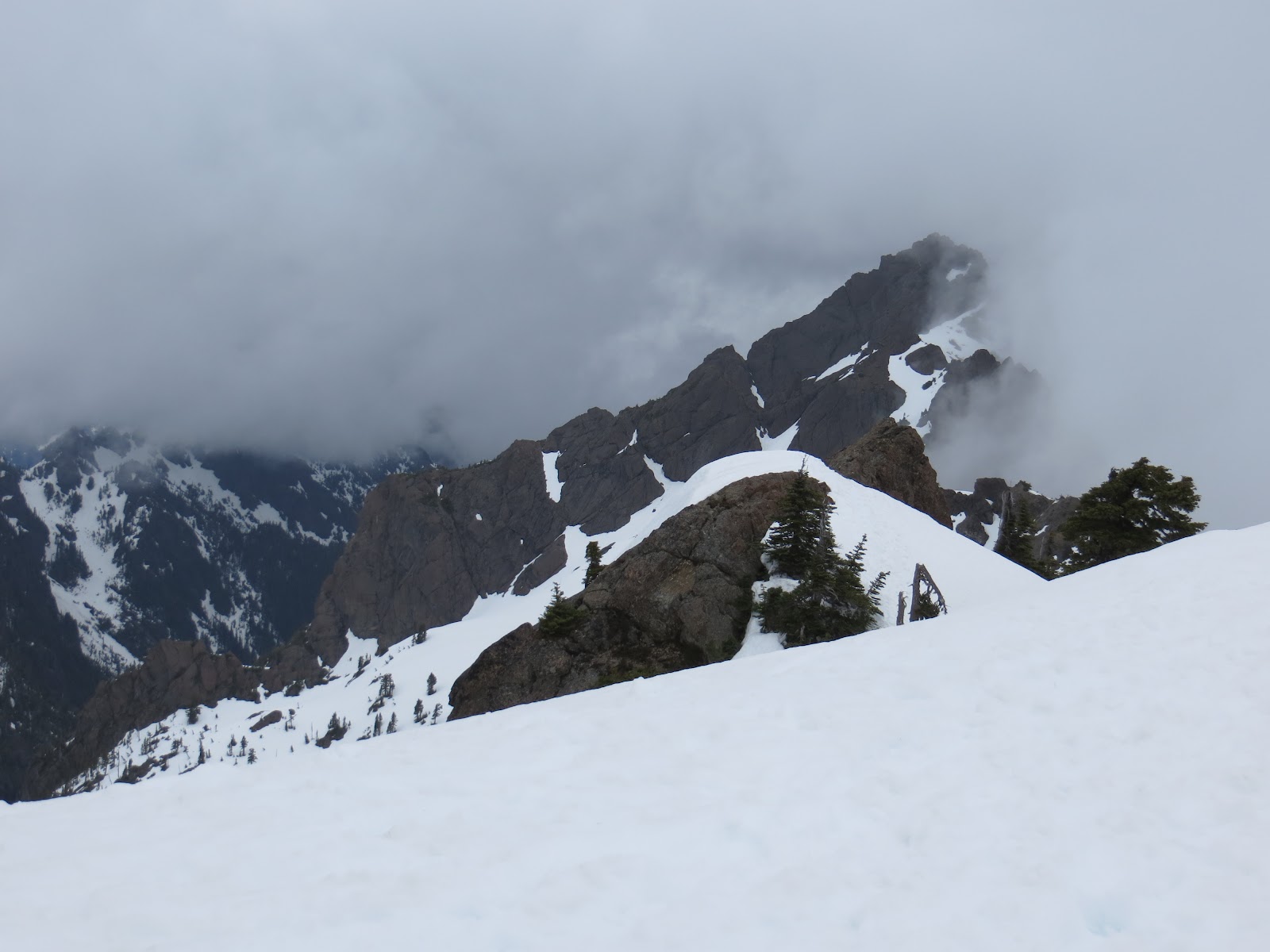
Passing several members of the group ahead of us, encountering one goat at the first false summit, and enjoying about 3 moments of sunshine, each lasting for no more that 10 seconds, we made a good time to the top. The view into the Olympics, even though roofed by dark cumulous clouds, was open, and a tiny sucker patch above the summit rocks allowed a peak into the Lake Cushman area. It was kind of like looking through a window, very cool experience actually.


The summit stay was windless and rather enjoyable. Looking towards the neighboring Mt. Washington, we discussed the possible traverse route with one of the locals who has done it several times, and just before our departure, a group of girls shared some of the wine they brought to the top with us.


And then…. of course there was the glissade. More solid at the top, not dangerously icy but hard enough to make bumps hurt, with some tricky spots trying to avoid a tree, dropping adventurers into a deep corridor, and spitting them at the flat area of the false summit. The bottom part was much smoother ride, long, curvy, most enjoyable with the snow softening with elevation lost, leaving us looking forward for next year!

Friday, June 1, 2012

Island Peak - 144 Days to Departure - Mt. Hood


The highest peak in Oregon, Mt. Hood was on our list for about a year. We missed the opportunity to climb it last season, and were keeping a close eye on how this year is unraveling, so when the reports suggested good climbing conditions and weather looked awesome for the whole weekend and beyond, it was a GO.


The long drive to Timberline Lodge was highlighted by a brief lunch stop in Portland during which we also visited the famous Powell’s bookstore, and strolled through a small food market in a hope to catch the Czech stand but they were not there.

The forecast did not lie; the sky was clear blue and temperature in high 70’s. With the Jeeps’ top off we cruised through small communities of Rhododendron and Government Camp, from where we turned to the winding road up to the trailhead.


After registering for the climb and a brief visit of the lodge, we still had time on our hands, so off we were back to Government Camp for an early dinner and several hours of rest at local Best Western.

 The stars were out and moon shined bright when we once again stood at the trailhead at a wee morning hour – just little bit past midnight. The first part of the route was a non technical slog taking us to the top of the ski lift. The terrain was uneven, crossed by multiple sets of frozen footsteps and CAT tracks here, making progress slower than anticipated.


From the top of the Palmer's lift, the route got steeper but still led on a non technical terrain. Here, little above 9000 feet, my body started reacting to the altitude. I felt sluggish, not short of breath, just little nauseated and not quite motivated to make another step.

The avalanche forecast was not good for today. We knew our chances of summiting more or less laid in Mother Nature's hands, and not feeling my best, I set a goal for myself to make it to the Hogsbacks, from avalanche perspective the safe part of the route, and I was quite happy to call it a day there. Yet then the sun started to rise... and we found ourselves surrounded by tall walls covered in white frosty coating reflecting the colors of the rising day, several camp sites tucked in the few wind sheltered areas along the route, and finally the famous Hogsback itself. The scenery was truly spectacular, feeding my eyes and mind with much needed fuel, and after a brief stop to snack and assess the conditions (the route turned out to be in a great shape), I found myself having plenty of energy to continue further so we geared up and off we were for the push to the summit via the Old Chute Route.


The sound of ice crystals constantly shifting down the slope accompanied our steps, at one point their flow was strong enough to cover the route, swallowing our feet in the appr. 5 inches of ice shatters. Then the last uphill came, luckily the group ahead of us kicked decent steps in the steep slope, and we took this staircase directly to the heavenly views of the summit ridge. From there it was just a matter of few minutes to cross to the very top of the mountain where, just as expected, gust slapped our faces, chasing us down after only few minutes and several quick photos.


Date: 5/13/2012
RT: 7 miles
El: Gain: 5200 ft


Wednesday, May 30, 2012

Island Peak - 131 days till Departure - Chelan Lakeshore Trail


Several years ago, and I’m not sure where, I’ve heard about a trail that lets a hiker venture into an world of nearly never-ending sunshine, astonishing display of wildflowers, and amazing views. Of course I wanted to go and see it for myself but at that time backpacking was not an option and hiking the 17.5 miles in one day was out due to a limited ferry schedule.


Now that there are no longer restrictions on my recreation activities; and with rain in forecast for the long weekend on our side of the mountains, I was eager to visit Chelan Lakeshore Trail and witness its beauty in company of resident rattlesnakes, bears and cougars.

The adventure started on Saturday morning when after a night at Best Western in Wenatchee and a very non nutritious breakfast consisting of waffles, muffins, and other gluten-full goodies, we drove to Field’s Landing and boarded Lake of the Lake II. Its front was loaded with overnight backpacks; obviously we weren’t the only one with this brilliant idea. It made us little uneasy first. While we were aware of the fact the trail will be busy, competing for camp sites with crowd of this size was not on our to-do list. Luckily after talking with several of the frequent visitors we gained an understanding that the hoards spread in the net of trails available in the area, which helped us ease a little and enjoy the rest of the hour long cruise taking us deep in the mountains, miles past civilization.


The on-foot part of our trip started at Prince Creek where we disembarked the vessel in a sort of organized chaos with everybody picking up a piece of luggage closest to their hands, bringing it to the shore, and then running around in a search of their own packs.


Once united with our belongings, our journey along the lake shore could start. The flower displays did not disappoint. Some slopes were purple with lupines while paintbrushes toned other ones red. We saw an amazing variety of other flowers including giant tiger lilies, columbines, yarrow, balsamroot, wild currant, and many more whose name I’m yet to learn.


Wildlife was also present. Chipmunks, lizards, Osprey flying above our heads. We closely missed a bear encounter (the other wildlife – group of boy scouts just ahead of us – must have scared it away), and as much as I was hoping we will avoid the snakes, I managed to step close to one, and it made me jump when it started slithering in the bushes. I did not see much of it, only part of the body and the rattle, but quite frankly even that was more than plenty.


Our Western Washington bodies not conditioned for the hot and dry 70 degree day broke quite a lot of sweat considering the trail was not much more than rolling hills. Finally after 11 miles we arrived at Moore Point, our destination for day one. It was busy with families already settled in, many who took the ferry all the way here, and were now using their big stoves and ovens to cook gourmet meals, setting up net for badminton, or simply displaying the collection of wine they had for later that the evening. And then, of course, there were backpackers like us, using their jet boils to prepare freeze-dried Mountain House dinners.


Finding a site little away from this scene was surprisingly not a problem. A perfect one right on the beach with large fire pit was calling our name. We made ourselves home and headed to pick firewood for the evening, cooked dinner and rested with cup of chocolate wine after the long day.


The morning came, and we found ourselves hitting the trail before 9:00 a.m, beating many others, including the Boy Scout group that just like us headed for Steheiken. Not only we beat most of our fellow hikers, we also managed to cover the first 2 miles of uphill while the sun was still hidden behind trees, and not so scorching hot.


The day was supposed to warmer than yesterday; but the wind came and it accompanied us for the rest of the way, making it rather pleasant to stroll along the bluff soaking up great views all around us. There was something very calming about the way the wind played among straws of a grassy meadows, about its power forcing waves to crush against the rocky shore, and it’s tenderness with which it carries scent of fragile wildflowers.


Getting up early paid off once more when we arrived to Steheiken and learned there the camp ground was full and there was a very last spot open at the overflow area. We gladly took it. People arriving after us got accommodated on the grassy picnic area which was not sheltered from the wind, as a matter of fact the wind never seemed to calm down there, and they did not have the opportunity to have a fire.


We spent the rest of the time exploring Steheiken and its surroundings. Dinner at the only restaurant in town was good, but the wait was about an hour just to get seats, and of course they run out of the ribs which we were looking forward to.

The social life in town consists of talks the rangers give every evening. The day’s topic was use of plants by Native Americans. It was actually very educational, not only we learned that bulbs of lilies are edible, we also learned how to make rope from bark of trees, soap from leaves of others, and at the end of the presentation we made some smoke using wood plank and a stick.


After an evening spent by fire, and a good night sleep, it was time to say good bye. It was a great trip, which gave us ideas for several future trips, and the fact we were able to get on the earlier ferry and arrive home at somewhat reasonable time, made a great ending to it.

Distance: 17.5 miles + couple short side trails
El. Gain: Appr. 2000 ft

Monday, May 17, 2010

What doesn't kill you, makes you stronger - Muir 5/15/2010

With our Mt. Rainier's climb attempt possibly only 6 weeks away, we headed to Camp Muir to check what condition we're in.

We started from Paradise under sunny sky and very thankful for bringing T-shirts. It was balmy 60 degrees there and the sun reflecting of the snow made it feel even warmer.


The first challenge came after about 1/2 hour of hiking when we found ourselves facing the steep slope leading to Panorama Point. Step after step we started to climb up. My legs were little sore on Friday after my interval training and I was very sure I will feel some pain on this part of the trail. To my surprise the pain never came and once I stood atop Panorama Point enjoying the views, I actually felt pretty good.

From there the trail led steadily uphill but on much gentler grade. There was a good crowd heading to the same destination today. Hikers, mountaineers, skiers, snowboarders. People of all ages, from kids to a 88 year old lady, wanted to enjoy the gorgeous day here on the mountain. And with so many people ahead of us, the steps were kicked in solid which made our ascend much easier.


My next challenge came at 9000 feet. I've been kind of slacking lately, doing more leisurely hikes, not really running yet this year.... so I expected to feel the curse of the 9000 ft this time to its full extend. Yet my personal death zone did not kick in this time. I continued in a slower but pretty steady pace to about 9600. That's where I developed dry throat and every breath I took was kind of choking me. It was not only annoying but it instantly drew all my energy.

The last 400 feet were never-ending. I was not making much progress. I was not even able to get from one flag marking the route to the other without stopping. With few members of our team who needed to be back in Seattle for their evening commitment, we were also running out of time. The camp was just above me now. The idea of having to turn so close to the destination made me push through the last 100 feet or so. I have to admit, I was rather exhausted when I reached the camp though and I had no desire to make another step up. I definitely have some serious training ahead of me if I want to stand a chance to stand atop of the mountain in six weeks.


Better go get started!

Sunday, March 21, 2010

Welcoming Spring on Red Mountain - 3/20/2010

After an easier stroll on Rampart Ridge last weekend, we were bound to do something more challenging and with weather being on our side, we decided to give Red Mountain a try.


The snow was packed hard all the way through Commonwealth Basin where we started our adventure. The basin was very pretty with a creek peacefully bubbling through, waterfall crushing down the rocks on the side, and many beautiful snow formation. The route gave us plenty of time to warm up on an easy (but rather slippery) terrain before we started to gain noticeable elevation.

Once we reached the ridge at the end of the basin, the workout started. It was uphill from there all the way to the top. There was a sign of a trail for a while but whoever left the footprints gave up pretty soon and from there we followed the ridge up breaking trail and some sweat.


Some parts of the route were softer than others but luckily we did not run into any serious postholing and rather comfortably booted our whole way up. (It's kind of interesting to see how crampons are getting so much use this season while the snowshoes could as well be in hybernation).


Once we broke from the more heavily forested part of the ridge, with the more open area came the views. First it was Mt. Rainier that popped into view and watched our back as we proceeded further up. Than all the other surrounding mountains showed their winter beauty and the higher we were, the more breathtaking the views became.

The day could not turn out better. The sky was clear blue, the air was filled with hot rays of the sun making it trully feel like the first day of spring.... and it felt so incredibly good to march up just in our base layers feeling the hot breeze touching our skin.


Then we found ourselves facing the last challenge of the ascend. From down below, it was a horrifying view. The slope was mostly open but due to a low avalanche danger safe to climb today so this was just a little concern. What made us go: "Hmmmmmmmmmm" was the angle in which the route led up. Hesitantly we summened our energy and set out to conquer the last part of the trip. The slope was trully steep but in the end kicking steps surrounded by all the amazing views did not seem that bad at all.


Finally we reached the summit which offered not only some more stunning views but also pretty neat lunch spot... if only it was not for the surprisingly cold wind that blew up there reminding us that despite balmy hot weather most of the time, it is still winter time here in the mountains.

Sunday, June 21, 2009

Granite Mountain 6/20/2009

The snow is melting fast from the mountains. Majority of the trail to Granite Mountain lookout was snow free and most of the parts that were still snow covered were accompanied with option to scramble on rocks around them.


The hike turned out great. Way better that we expected actually. We left the trailhead with all the surrounding mountains socked in and no views available but instead the gorgeous views the trail let us admire little things along the way such as neat rock formations, blueberry bushes loaded with tiny tiny berries(can't wait to come back during fall), stream bubbling through meadow, and hundreds of sweet smelling bear grass blooms.


Once we got higher and were close to reaching the top, the weather changed a bit - to our advantage. The clouds rolled around us, revealing little views here and there. It was like looking through a window kinda.


Progressively the clouds got lighter and offered more views. It was not the grand views this place holds on a clear sunny day, but still it was decent show. Combined with the soft clouds appearing and dissapearing at various spots the scenery was beautiful.


The weather cooperated really well. It was warm the whole time and not a single drop of rain hit the ground while we were on the trail.


Another good day to be in the mountains!