Showing posts with label mountaineering. Show all posts

Wednesday, July 16, 2014

Eldorado, WA 6/21/14 - 6/22/14

With yet another sunny weekend we cannot not pass the temptation of Eldorado. It means getting up at 4:30 a.m. in order to be at Marblemount Ranger Station before the permits run out. It turns out our worry is unjustified, there is only one party of 2 ahead of us, plenty of permits left. Other areas like Boston Basin, or Hidden Lake Peak are quite open too. Where is everybody? Enjoying the naked bicyclists in Seattle?


 The initial creek crossing is easily accomplished on a wide log which is wet but not slippery.
From there we used several smaller logs to cross marshy areas and another smaller stream. Then, finally, we are on the unmaintained climbers route as the trailhead sign referred to it.

At first there are some blowdowns to deal with but the path gets relatively clear within the first ¼ mile or so and after that there is only an occasional tree to climb over or under.


 It is nice not to deal with snow on the boulder field but we are  not lucky to enjoy the same conditions all the way up. The snow starts at the upper reaches of the second boulder field, and it is soft and weak, and collapsing under our feet. It does not feel the best not to know if our next step is landing on solid rock or a snow bridge. It is a relatively short section though, and if the warmer
temperatures persist for few more days, it might be melted out before next weekend comes.

The glacier is in a great shape all the way to the camp, no visible crevasses along the route or nearby. We camp at the bivi site where we find a water source (decently trinkling snow melt water), it is going well in the afternoon, not so much in the morning, so filling up in the evening is advisable. The toilet is melted out and in working condition, always a good thing.


 We start towards the summit in the morning, not particularly early since we only have about 1500
feet left. We chose to use crampons but the snow is already softening on the east facing slope. Not much route finding needed, it’s quite a straightforward climb. At one spot our rope leader notices a crack which the previous kick steps crossed. We decide to avoid the area by climbing to the left.


 The top still has a cornice hanging towards us, and though there is a slight detour. Instead of
heading straight up towards the knife edge, the route leads us behind it where we found ourselves on a wide ledge, and few steps up a snow bank got us to the base of the final ridge.

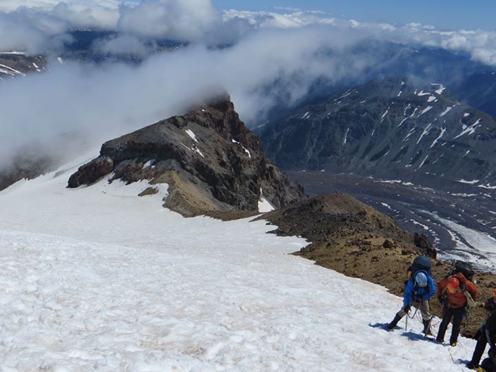
The knife edge is not as melted as we were hoping for, and the upper part is much steeper than it usually is later in the season. There is a boot track all the way to the top which we follow but we do not like the approximately 60% slope and the snow condition which are not in favor of successful self arrest should we slip. We make it part way up but in the end we decided to play it safe and turn before reaching the high point.


Ruth Mountain, WA 6/7/2014 - 6/8/2014

The forecast seems promising, and I’m craving some North Cascades views. Ideas are flowing. In the end we decide for Ruth Mountain. Neither of us climbed it before, it will be good to explore new territory.


 We make a plan to camp at the summit to enjoy sunset and sunrise. We leave Seattle optimistic despite the fact the forecast downgraded from mostly sunny to partly sunny but the closer we are to the mountains, the more obvious it becomes that the partial sunshine will be hard to find. Clouds roll across the sky, cutting off the mountain tops. Summit of Ruth might not be the best place to camp after all. We stop at Glacier Ranger station and pick up the permit anyway, just in case it clears later during the day.

The approach is on an easy trail through valley where spring desperately tries to start. First flowers are appearing along the trail, snowmelt creates beautiful waterfalls. Yet the remainders of winter are still present. Large fields of avalanche debris we have to cross, weakening snow bridges that slow our progress. Overall the trail is in better shape that it was last year when we dealt with at least 15 bad snow bridges on our way to Hannegan Peak. This time the number is down to 4.


 Solid snow coverage starts just below the switchbacks to Hannegan Pass. The conditions are
good, both crampons and snowshoes remain strapped to my backpack. Heading up the steep snow covered scramble slope I opt to reach for my ice axe.

With several groups ahead of us a path is set on the traverse to Ruth arm. Once we get there we face a decision. Should we proceed to the top as planned? Or should we perhaps camp here. We’re not the only ones who try to make our mind. A group of three skiers are contemplating as well. In the end they decide to push on. With dark clouds rolling towards us, the summit does not look inviting for an overnight stay.  Thinking we might even head back to the car if weather worsens, we drop our overnight gear and head to bag the summit.


 The views are excellent. We don’t see much of Shuksan or Baker but there are many other peaks that are below the clouds, including neighboring Icy.

In the end we decide to camp on the arm. The clouds are coming and going but otherwise it’s a pleasant evening, warm and calm. We don’t regret the decision. The sky clears just before sunset. Moon rises above Ruth. We have a chance to enjoy some incredible colors.


 The morning brings more clouds. Where there was Ruth yesterday, we stare into a white void. We pack and head down. The clouds are much lower today, the rain is imminent but we make it out dry. Couple hours later we raise our glasses. Cheers to another great trip!


Friday, August 16, 2013

Mt. Rainier Climb 7/4/2013 - 7/7/2013


The weather is good, the conditions are good, we have decent amount of time on hands. A perfect combination of elements for our Mt. Rainier attempt. This is the second time we are giving it a try. Two years ago we had perfect conditions while climbing the DC route; however one member of our 5 man rope team got sick and another felt completely exhausted when we reached elevation of 12,700 ft and for the safety of the entire group we decided to abandon the expedition and return to base camp.


This time we work with much smaller team. Dave and I leave Seattle on the Thursday afternoon, and drive to White River Campground. From there we hike to Glacier Basin where we meet with Darren who arrived first thing in the morning to secure our permits.


We spend the first night at Glacier Basin Camp. We do not see or hear the bear who kept campers company the night before, and enjoyed a good night sleep.


From Glacier Basin the path gets steeper. We climb up Inter Glacier, which is still in good shape with only one big crevasse opened and several smaller ones on the sides. Many people cruise the slope without roping, we choose to rope up both for safety and rope travel practice.


After learning the traditional traverse onto Emmons Glacier is exposed and not easy going, we opt for the alternative and head few feet past Camp Curtis from where an easy short scramble connects us with the path leading to Camp Shurman. The camp is now just a short distance away. It is nice to arrive early enough to have time to prepare for the climb, enjoy dinner and still catch few hours of sleep.

Midnight comes up fast, quick breakfast, and off we are on our way to the top of Mt. Rainier. The route is like a highway, we see beams of headlamps ahead of us and many follow.


To our liking, the route is rather straightforward. Several climbers we met mentioned it was much more crevassed than it usually is at this time of the year but we only end up climbing over one crevasse. Well, there is little bit of jumping involved too but otherwise we find the route in a good shape.

The summit is completely windless when we arrive, later a slight breeze picks up. It is cold up there but not the miserable kind when the frost bites you no matter how many layers you have on. Keeping pleasantly warm in our down jackets, we enjoy the 360 degree views. One party camps in the summit area. They are little bit off the summit so we do not have a chance to talk to them. Sunrise must be nice from here. Carrying overnight pack all the way up no so much.


With the nice firm snow at the top the descent, at first, goes much smoother than we expect.  It becomes more tiring once we reach softer snow and have to be careful about slipping. The sun is at full force at that time, the heat is exhausting.


It is nice to have one more night at Shurman. It would be brutal, long day, if we tried to walk out today.  Instead we chat with the ranger and his wife for a while and then decide to take a little nap - that lasts until 7:00 a.m the next morning.


On our way out we meet several groups equipped for a summit attempt. If the good weather persists many more will come and seek the challenge of Rainier. For us this quest is over but  the summer is just starting and plenty of other destinations await.


Friday, June 1, 2012

Island Peak - 144 Days to Departure - Mt. Hood


The highest peak in Oregon, Mt. Hood was on our list for about a year. We missed the opportunity to climb it last season, and were keeping a close eye on how this year is unraveling, so when the reports suggested good climbing conditions and weather looked awesome for the whole weekend and beyond, it was a GO.


The long drive to Timberline Lodge was highlighted by a brief lunch stop in Portland during which we also visited the famous Powell’s bookstore, and strolled through a small food market in a hope to catch the Czech stand but they were not there.

The forecast did not lie; the sky was clear blue and temperature in high 70’s. With the Jeeps’ top off we cruised through small communities of Rhododendron and Government Camp, from where we turned to the winding road up to the trailhead.


After registering for the climb and a brief visit of the lodge, we still had time on our hands, so off we were back to Government Camp for an early dinner and several hours of rest at local Best Western.

 The stars were out and moon shined bright when we once again stood at the trailhead at a wee morning hour – just little bit past midnight. The first part of the route was a non technical slog taking us to the top of the ski lift. The terrain was uneven, crossed by multiple sets of frozen footsteps and CAT tracks here, making progress slower than anticipated.


From the top of the Palmer's lift, the route got steeper but still led on a non technical terrain. Here, little above 9000 feet, my body started reacting to the altitude. I felt sluggish, not short of breath, just little nauseated and not quite motivated to make another step.

The avalanche forecast was not good for today. We knew our chances of summiting more or less laid in Mother Nature's hands, and not feeling my best, I set a goal for myself to make it to the Hogsbacks, from avalanche perspective the safe part of the route, and I was quite happy to call it a day there. Yet then the sun started to rise... and we found ourselves surrounded by tall walls covered in white frosty coating reflecting the colors of the rising day, several camp sites tucked in the few wind sheltered areas along the route, and finally the famous Hogsback itself. The scenery was truly spectacular, feeding my eyes and mind with much needed fuel, and after a brief stop to snack and assess the conditions (the route turned out to be in a great shape), I found myself having plenty of energy to continue further so we geared up and off we were for the push to the summit via the Old Chute Route.


The sound of ice crystals constantly shifting down the slope accompanied our steps, at one point their flow was strong enough to cover the route, swallowing our feet in the appr. 5 inches of ice shatters. Then the last uphill came, luckily the group ahead of us kicked decent steps in the steep slope, and we took this staircase directly to the heavenly views of the summit ridge. From there it was just a matter of few minutes to cross to the very top of the mountain where, just as expected, gust slapped our faces, chasing us down after only few minutes and several quick photos.


Date: 5/13/2012
RT: 7 miles
El: Gain: 5200 ft