Showing posts with label Vacation. Show all posts

Wednesday, July 16, 2014

Rim-Tim-Rim, Grand Canyon 5/1/14 - 5/3/14


Arriving at the South Rim Backcountry office, we hope for a 3 night permit in the Grand Canyon corridor. Permits for the day are already gone. We are told to come back first thing the next morning. We won’t be able to get 3 nights but if we are there just as they open, we are guaranteed 2 nights. We can undoubtedly complete Rim to Rim in 3 days. Rim to Rim to Rim... well we will find out.

Securing our permits the next day, we prepare for our trip. The backpacks are back to being loaded with gear and food, and plenty of water as the South Kaibab trail on which we choose to descent is dry.


 Our adventure starts early in the morning of May 1st when the bus drops us off at the South Kaibab trailhead. Everybody gets off here but not everybody embarks on the same journey we have in mind for ourselves. Judging from the size of peoples packs, most of the crowd are day hikers.

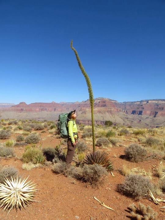
The canyon appeared desolate and barren from up above but now while we are descending deep into its gut, the experience differs from the initial perspective. The flora consists of blooming cacti plants, fauna is represented by lizards. There are many of them everywhere along the trail. Green and brown, large and small, and all of them are quickly rushing out of our way.

We come across the first peek-a-boo view of Colorado River. It still seems so far below us. The trail relentlessly descends towards it on a series of switchbacks. Not a paradise for those with creaky knees.


 It’s a small celebration to get to the river. The sun is now beating on us, and the idea of chilling on
the beach brings smile to our faces. But before we can do that  we have to endure the first uphill of the day to get to the Bright Angel Creek Camp. The trail ascends on a very gentle grade which in the heat feels much steeper. Some campsites are already taken. We find one we like at the very end of the camp. There is a beautiful tree on our site full of elongated red blooms. Later we learn it is pomegranate tree. I have never seen one before, and even though somebody likely planted it here, seeing one growing freely in nature feels special.

After the camp is set, we finally have a chance to enjoy the waterfront. Swimming is prohibited in Colorado River due to strong currents but wading along the shore is fine. Afterwards we explore surrounding areas including Phantom Range where we have a drink, and later in the evening we join a ranger talk on the topics of the first explorers of Grand Canyon. When the dark falls, the ranger takes us on a scorpion hunt. We find at least three of them nearby to where we were sitting for the talk.


 The challenge that lies ahead of us the next day is a 28 mile round trip to the North Rim and back. The heat took a toll on me yesterday, I’m not feeling the strongest, and we opt for additional hour of sleep. Still I do not feel too well so we decide to take it easy and stroll only as far as we can make it. Cottonwood campground 7 miles from here on an easier terrain would make a good destination
and a decent RT of 14 miles.

We make a good time on the flatter trail and after a water stop at Cottonwood I feel strong enough to push it further. And then further, and further yet. There are waterfalls, and blooming trees in the proximity of the water source. And signs showing the layers of rock and our location. We’ve made it long ways but there are still many layers above us, and the trail starts steepening up.

Pushing through a couple miles traverse on a ledge with a sizeable drop off much closer that I care for raises my heart beat. I really do not care for this section much despite the fact the rock around us is my favorite red color and the canyon we’re ascending is truly beautiful. Soon we should get to the last water source en route and that is good because we’re running out.


 Several people confirmed at the ranger’s talk yesterday that water is running at the tunnel station but
today it’s dry. Not even a drop. It’s not good. We’re only 2.5 miles away from the North Rim, so close on a scale of the trip, yet without water 2.5 miles can stretch very far. It’s all uphill, the description talks about relentless switchbacks the last mile or so. We save our last few sips and start heading to the rim.

In the end the trail is less steep than I expected and we make good time. The water is running. There are several other trail runners atop, all of them passed us on the way up, even though some of them we kept pretty close to. They are doing the whole rim-rim-rim in one day. I consider that crazy, and not all of them look in a good shape to run another 22 miles with significant elevation gain, but everybody to their own.


 After a quick visit and few of photos, we start heading down. The North Rim is officially still closed
for the season. With none of the buildings open, there is no reason to linger. The views are along the trail, not here by the treed trailhead, and quite frankly I’m also anxious to be past the traverse.

Descending the traverse turns much easier that the image that formed in my mind. There is a section or two where I am extra careful but otherwise we zoom right through. I have particularly good energy and even jog the flatter sections.

Backpacking boots are not for jogging I learn when my feet start burning at about milepost 21. They go from all happy to all achy within minutes and upon inspection I find couple blisters formed in between my toes. The rest of the way I hobble.


 It feels extremely good to dip my feet in the cold creek rushing by our campsite but even after the
cold bath my feet remain tired and sore. Tomorrow we have to walk out. It means hiking over 9 miles, gaining more than 4000 ft of elevation. Right now I hardly can manage the few flat steps to Phantom Range where we get celebratory drinks. Yet when tomorrow comes, our feet feel rejuvenated. They do not object slipping back into the boots. We start early to beat the heat, the temperature is forecasted to reach 98 degrees. We  are among the first people on trail. The sun already basks
the upper portion of the canyon walls but for now we are hiking in the shade.

The shade does not last long. The canyon betrays us to the heat just when we start up the first series of switchbacks. Our pace slows considerably but we still pass some people. And then others pass us.


 The first of the three water station cannot come fast enough. We drink, we rest, and off we are
towards water station #2. That’s how I break the trail into smaller, more manageable pieces - water station #1, #2, #3 and then the final push towards the rim. The trail itself is not difficult. Well established path, steeper at spots but nothing I haven’t done before. It’s the heat that’s getting to me. I have never done well in heat.

At water station #3 I feel really exhausted. It’s only about 1.5 miles to the top, and some of it shaded according to the ranger we meet, but I have no desire to move from the comfort of the shaded shelter where we rest. I can imagine closing my eyes and taking a nap. It’s a tempting desire. But I fight it. I dunk my shirt into the water. It’s cold, raising goosebumps on my overheated skin. It does the trick, cooling me down instantly. I wish I used the trick earlier. Afterwards the last stretch is a breeze.


We made it happen. Rim-Rim-Rim in three days. Feeling good about that accomplishment!

Friday, June 13, 2014

Beaver Falls, Arizona 4/28/2014

We have a relatively late start, crawling from out tents around 8:00 a.m., but with less than 6 miles to cover today, that is not an issue.


Mile one is the most adventurous one. We leave camp and tread the now familiar path to Mooney Fall. From there we are on a new turf. The exploration begins as we lower ourselves into a narrow cave and descent some 20 meters enclosed by its wall. It leads us to an opening from which we can see the canyon ahead of us. It’s feels like a piece of Amazon was dropped in between the barren canyon walls, a thriving forest of jungle like trees and plants.


The next stage of our descent is aided by chains. Downclimbing is the easiest way down. The cliff is steep, vertical, but foot placements are surprisingly good and we progress much faster than expected.


When we reach the last 15 meters, the chains are replaced by ladders. The waterfall touches the bottom just few feet away, sending a large cloud of misty sprays in our direction. Its powerful roar is overwhelming.


It’s easy to follow the well trodden trail at the bottom of the canyon. It’s equally easy to get distracted by the multiple side trails leading to variety of viewpoints. The canyon is just as breathtaking as it appeared from above. The greenery is met with the saphyre flow of the river. Unique plants line the trail, many of them showcasing their blooms. There are hundreds of lizards running for their life as soon as they feel the soft vibration of our steps. Luckily we don’t come across any snakes.


2.5 miles, 3 river crossings, and several shorter scrambles later the view of Beaver Falls opens in front of us. The waterfall consists of several terraces. The pools in between them are small but deep enough for a swim. Like many others we wade through the bottom pool and scramble the canyon wall up to the higher ones. From this vantage point we see the water topple over the ledges until it becomes a river again, smoother and calmer.

Worthwhile side trip if you have the time to take it. And if you do, come early. Once the sun sets behind the canyon wall, the temperature drops significantly. It’s great for photography as then the reds really stand out but no so much for swimming.


Tuesday, August 6, 2013

Angels Landing, Zion NP, Utah - 6/11/2013

Being quite afraid of heights I’m really not sure what possessed me to even think about doing this hike but somewhere I manage to pull enough courage to set my foot on the trail, and holding firmly to the chains, make it all the way to the top. My heart beat fastens few times, but my legs surprisingly never get wobbly, and I even do not get dizzy at the top so that I can actually enjoy the views.


For those not familiar with this hike in Zion NP, the trail is initially flat as it crosses the valley around Virgin River. The leisurely walk does not last too long, after about 10 minutes the switchbacks come and lead hikers steeply up to area called Refrigeration Canyon. Those who do not start early enough to beat the heat can find a brief refuge from the sun here and much welcome breeze.


Another set of switchbacks starts shortly afterwards, ever steeper than the lower ones; however the trail is still paved in this portion of the hike, and taking it easy, we see people of all ages and many with questionable conditioning successfully completing this part.


Scouts Lookout atop the switchbacks makes a decent viewpoint and a good turnaround point for those in less than good shape or those who are not much of thrill seekers. The last half mile is a narrow, exposed ridge with sheer drop offs of each side. Most of the ridge is aided by metal chains but some steps still can be rather intimidating.


The views from the top are pretty amazing and if the conditions are good (rock dry, not super windy)
going down is, to my surprise, much easier than I feared it would to be while we were heading up.

RT: 5 miles
El. Gain: 1448 ft


The Narrows, Zion NP, UT - 6/10/2013

I am thrilled to secure the very last two permits for The Narrows in Zion National Park. Initially we were hoping for a backpacking trip to allow ourselves enough time for photos, but arranging the whole trip on a very short notice, we are quite lucky to get at least the day permits for the hike.  We have never done any canyoneering or river hiking before and we are excited to explore this totally different world. 


The adventure starts early on that Monday morning when a shuttle takes us from Springdale to Chamberlain’s Ranch, and from there we are on our own to follow Virgin River downstream all the way back to the park. 


It is shortly after 7:30, and it is already a beautiful day. Blue sky, and sunshine, pleasant temperature of around 70 degrees for that moment which was later expected to rise above 100 F. Taking advantage of the cooler morning, we try to cover as much distance as we can in the beginning of our trip. We are on a dirt road, walking through a pasture. The scenery is pleasant, but the real beauty lays ahead of us, and we do  not have reason to procrastinate here. 


Finally we meet with Virgin River and step into its water. It is only ankle deep at first and many large rocks make it possible to make  first few crossings without getting wet. My approach shoes do not handle the wet rock well, so I soon swap them for the rented 5.10 Canyoneers and with their sticky soles, they immediately become my best friend. 


The water remains shallow for the  first several miles, during which we enjoy views of the rock walls reaching to the sky above us, and first Narrows section where the walls come closer together and we can from up close and personal admire the craftsmanship of the river carving this canyon. 


It is not as easy as one would think to make the 16 miles downstream. As the water becomes deeper, the crossings become more challenging. Our pace slows down considerably even at spots where the flow is mild. 


We emerge at the other end after 11 hours of constant ooh and aah, knowing that this is a hike we will gladly return to do again if opportunity arises.


Chitwan NP - October 2012

How long does it take to drive 90 km (60 miles)? By bus approximately six hours we are told at the Katmandu office of Hotel Park Side. Round ticket would cost little less than $10.00. We accept the offer. Just two hours earlier rep from another agency told us that all buses were full due to national holiday and the only way to get to Sauhara was to hire a private driver for $170.00.


The next morning we set out for the bus station. According to the directions it’s merely 15 minutes walk along the main road. I don’t remember seeing a bus station in that direction, neither does Dave but our hotels staff reassures us that we won’t miss it.
And it indeed would be hard to miss. The buses line both sides of the road. They are long lines without any indication when each bus leaves or where is it going. The on site helper keeps busy seeing people into the correct one. Thankful for his service, we follow him  to a bus nearby where the driver checks our tickets and leads us to appointed seats. The bus is old but seats seem quite comfortable. Air Conditioning is provided by a fan mounted on each window. No other luxuries.


The bus fills quickly. Some people are even placed on a bench in the drivers cabin. We conclude the uncomfortably looking wood bench with no personal space must be for those who could not afford full price tickets.


A whistle sets the buses in motion. They take off at once and float down the street heading out of Kathmandu. Before we bid farewell to the city, we make a stop at a gas station. Long line of busses means a long wait. Local kids run among the busses trying to sell water and snacks to the bored passengers.


In about half hour we are in motion once again. The road is in poor condition and gets worse once we are past Kathmandu’s city limits. It snakes, too narrowly and too close to a treacherous cliff, down a steep valley.


The lowlands are words apart from the cold inhospitable mountain regions Nepal is also home to. Agriculture thrives here. Slopes of the valley shine green, every space is utilized for crops of various kinds. Large banana trees line the road.


The air is hot and humid, weighted with dust of our crumbling surroundings. The road, a highway running between two major cities, is in worse shape than many forest roads in US. As we cover the distance we are searching for a single building that would not be in desperate need of repair. Our search yields no results. The luckier people own a shabby, unfinished house, for the poor home is often nothing more than a straw roof supported by 4 sticks.


Sauhara, the entrance to Chitwan NP is in better shape. It’s a tourist village and with tourists come money. We are picked up at the bus stop by a rep from our hotel and in a terrain vehicle transported to the premises where we will spend the following 3 days. Parksite Hotel. The rooms are spacious and clean. Stuff friendly as far as we can tell. Awaiting our first adventure, we strike a friendly conversation with a couple from Holland with whom we share the next 3 days. There is also a family from Canada, husband and wife with their 2 children, who relocated to Kathmandu for a year so that the husband can help local hospital. Hearing about the little victories they celebrated along their now 3-month journey gives us an unique look on the challenges life in third world countries like Nepal can rise.


Chitwan NP is known for it’s healthy population of hippo’s, deer, crocodiles, and monkeys, sightings of tigers and sloth bears were also reported. We spend the following three days trying to catch our own sight of these animals, in canoe, jeep, and on foot. Fall when the grass is tall and strong, is not the ideal time for a visit, and excursions deep into the jungle are not permitted for safety, however we are still lucky to see several hippos, deer, family of monkeys, a crocodile, and a wild boar. The opportunity to visit elephant breeding center and pet baby elephants is another highlight of this trip.


Wednesday, January 30, 2013

Onto Lukla - October 2012


Trekking to Everest Base Camp starts with an adventurous flight from Kathmandu to Lukla. Hundreds of passengers take the flight daily during the high season in October and November. The planes are small and noisy, they rattle, and on average two of them crash every season.

Getting to the plane is experience on its own. As we bulldoze our way through the overcrowded domestic section of Kathmandu airport I try to imagine doing this without an assistance. There are no signs to point travelers to any directions, save the right one, and the sporadic personnel speak very limited English.


Closely following our guide we arrive at an unmanned scale and drop off our entire luggage. An officer appears and briefly scans our over-the-limit belongings. Few handshakes and a nod later, we proceed through the door and take a short bus ride to our plane.

The scene is lively. Previous passengers are exiting the plane; their luggage is loaded onto a cart, and a re-fuel crew is making sure there is enough juice for another round trip. Inside there are two rows of seats, separated by a narrow corridor. Sign stating “Emergency Axe” catches my attention. Hopefully we won’t be in a need of using it. The flight day is short, and passengers plentiful. We don’t waste time idling around. As soon as the last seat is taken, the door close, and shortly afterwards we are airborne en route to Lukla.


The flight is just about 45 minutes. We soon leave the crumbling city behind and our windows offer views of much more pleasing nature. Farmlands open below us with their fields cascading on hillsides. Various shades of green neatly stacked one below the other. Deeper in the mountains, settlement became less frequent.  We are flying through a valley, surrounded by forested slopes. The dense growth surprises me in this altitude.


One last turn and Lukla appears in view; small town scrunched in a valley in the elevation of 2,860 metres (9,383 ft). Lukla contains an airport, several tea houses catering to visitors during the trekking season, and a variety of stores offering last minute trail supplies for those starting their journey, and souvenirs for those returning. There are also couple of coffee shops claiming to provide free wi-fi; however the service is not reliable and the connection is often painfully slow.

Lukla is served by the Tenzin-Hillary Airposr, one of the most extreme and most dangerous airposrts in the world. Its single runway is 460 m x 20 m (1,510 ft x 66ft) with 12% gradient. Due to the terrain - there are high slopes immediately after the northern end of the runway and a steep angled drop of about 2,000 m (6,600 ft) at the southern end, there is no prospect of a succesfull go around. You either land, or you crash. 


Exiting the aircraft, I take a deep breath of the fresh mountain air. It is crisp, its chilliness brings a soft pinch to my sinuses but at this time I hardly notice. The moment we’ve been waiting for is here. Curiously looking around, we take our first steps in the Himalayas, excited for the adventure ahead. 

Tuesday, November 27, 2012

Arrival to Kathmandu - October 2012


The bus drops us off at the airport hall which is about 100 feet from where the plane unloaded us. I estimate that we could have walked the distance faster.

There is the typical airport buzz present here, casual conversations take place between travelers as they are waiting to go through customs. The line is not moving fast.

Around us is a room in a need of modernization. The only furniture is an old table on which custom forms are scattered and few metal chairs. The emptiness has a cold, nearly unfriendly feel. More of an interrogation room than an airport hall it reminds me, and that feeling gets even stronger once our turn comes up.

We face 4 immigration officers. They sit in a row on the same metal chairs the rest of the room is furnished with, their faces show no emotion.

The first officer takes our money. $40.00 each for a 30-day visa. We step towards the second one who scans our passport and hands it down the line. Now we are in front of the third officer. His job is to check our visa forms. Once he approves them, all our paperwork makes one last move. The last officer places a visa sticker to our passport and we are free to go.


Outside we find a beehive of people, each pushing their way through the crowds with a specific task in their mind. Hundreds of luggage helpers. Taxi drivers on their hunt for clients. On the other side of the street there is a very long line of reps from variety of travel agencies. After 28 hours of travelling I’m thankful for finding our rep in the beginning of that line. We receive our first friendly welcome and in the next five minutes we are leaving the chaos behind.

It’s completely dark, street lamps are non existing. Not much can be seen outside except for loosely lying bricks and piles of sand. It’s like driving through a never ending construction site which is a sight as we learn later common not only to this particular part of town but to the whole country. The road gets from bad to worse, the bumps feel bigger and they are more frequent the further we get from the airport but eventually this mostly primitive road drops us off in front hotel Shankar. During its prime it must had been a stunning structure. Now the siding is peeling and its white color has long been spoiled by mossy mildew but the architecture itself still impresses us.


The interior is preserved better, a large hall decorated with mandalas, plenty of light and has welcoming feel. Same goes for the room. Everything is clean, there is plenty of space, and soon after our arrival a basket full of fruit is delivered.

It’s about 2:00 a.m. now, time to get some rest before our Nepal adventure begins tomorrow.

Wednesday, November 14, 2012

Hong Kong - October 2012


The flight seems never-ending, but finally breakfast is served and shortly afterwards we start descending. Underneath us lies Hong Kong. The city is just awakening and in the mist of this hazy morning we start recognizing shapes of the islands. As we get closer a skyline rises and finally we are low enough to distinguish individual buildings.  Our adventure is about to begin!


After a short wait at the customs we get our visa. We follow the crowd of travelers into a large airport hall. Hotel booths with their bright advertisements compete for our attention, a line of taxis awaits outside. At the information desk where we learn the fastest and most comfortable way of getting to the downtown of Hong Kong Island is the Airport Express. We make our way through the pond of people rushing to their gates or aiming for the shops and then onboard the train we leave the airport scene behind. 


Star Ferry is the first attraction we decide to experience. The ferry, running since 1880, was named as one of 50 places of a lifetime by The National Geographic Traveler and is known as one of the world’s best value-for-money sightseeing trips. The design we see today is from 1950’s, wooden construction 2 decks high. The bottom is painted green, top part is white and along both sides hangs life wheels in matching colors. The interior is simple, open floor with several rows of benches. Surprisingly we find out the front is air conditioned. 

It is a short sweet ride, and on the other side we step out onto Kawloon located North of Hong Kong Island. We don’t have enough time to explore the whole peninsula but several hours are plenty to get a feel for Tsim Sha Tsui district. That is if shopping is not on your “must do in Kawloon” list. In that case reserve several days as the streets are lined with stores, any brand name you can think of seems to be represented here. 


We are leaving the expensive luxuries behind headed for the waterfront. Avenue of Stars offers a stunning panoramic view across Victoria Harbor. It’s grey and blue colors compliment the skyline of Hong Kong Island. Set into the promenade are plaques honoring celebrities of the Hong Kong film industry.


Our next stop is Kawloon Park. Contrary to the bustling streets of Kawlooon here in the park one can find a moment of peace and solitude. Many locals come here to practice Tai Chi. We take a walk in the gardens, admiring the great variety of plants. Attractive blooms, leafy water plants, bamboo forest, that all keeps the camera busy. The trees especially catch our interest with long aerial roots hanging from the branches, some nearly touching the ground. More aerial roots grow near the bottom of their trunks, a complex net of them, clinging to walls for support.


The time is pressing us to return back to Hong Kong Island. Again we take the Star Ferry. Our eyes are on Hong Kong’s skyline, a dense forest of skyscrapers. Later we try to get a bird’s view of it from the 55th Floor of 2IFC tower (International Financial Centre), the second tallest building in Hong Kong but it is Saturday, a holiday as we are told, and we are not granted permission to enter the building.

Instead we head for the Mid-Level Escalators, the longest series of outdoor covered escalators in the world. There is a total of 20 separate escalators with streets that bi-sect the system. The ride is about 800 meters long and takes approximately 20 minutes. Along its course we get a peek at the district of SOHO, an entertainment district with many bars, restaurants, night clubs, and art galleries. 


Shortly afterwards  our time here is up. So long Hong Kong!  Our vacation is just starting and many more adventures await!